
He Swore This Dam Was Safe. Hours Later, It Wiped Out an Entire Valley.
On March 12, 1928, legendary chief engineer William Mulholland personally inspected the St. Francis Dam in California after muddy leaks appeared along its abutments, declaring the concrete structure completely safe. Less than twelve hours later, the dam catastrophically ruptured, unleashing a 140-foot wall of twelve billion gallons of water. The raging torrent obliterated towns, carried 10,000-ton concrete blocks up to three-quarters of a mile down San Francisquito Canyon, and claimed over 400 lives in California's deadliest civil engineering disaster.

In this dossier (9 chapters) ▾
Historical Dossier: The St. Francis Dam Collapse & The Fall of William Mulholland Location: San Francisquito Canyon, Los Angeles County, California | Date: March 12–13, 1928 | Key Figures: William Mulholland, Harvey Van Norman, Tony Harnischfeger
The Titan Who Watered the Desert
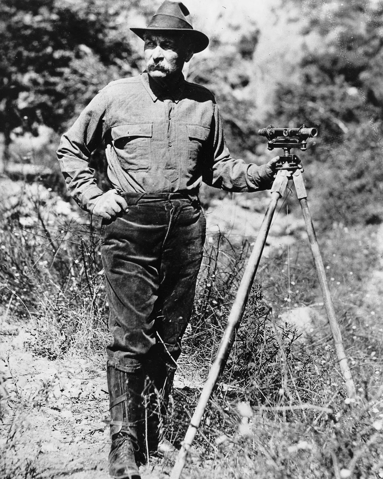
In the 1920s, no civil engineer in the United States commanded more reverence than William Mulholland. An Irish immigrant who had arrived in California in 1877 as a ditch tender digging zanjas for the municipal water company, Mulholland had educated himself by candlelight in mathematics, geology, and engineering.
Through sheer willpower and autocratic brilliance, Mulholland became Chief Engineer of the Los Angeles Bureau of Water Works and Supply (now LADWP). His crowning masterpiece was the 233-mile Los Angeles Aqueduct, completed in 1913, which brought snowmelt from the distant Owens Valley across the Mojave Desert to transform Los Angeles from a dusty desert outpost into a thriving global metropolis. When water cascaded down the Owens River Cascades at the opening ceremony, Mulholland famously told the cheering crowd of forty thousand:
“There it is, gentlemen. Take it.”
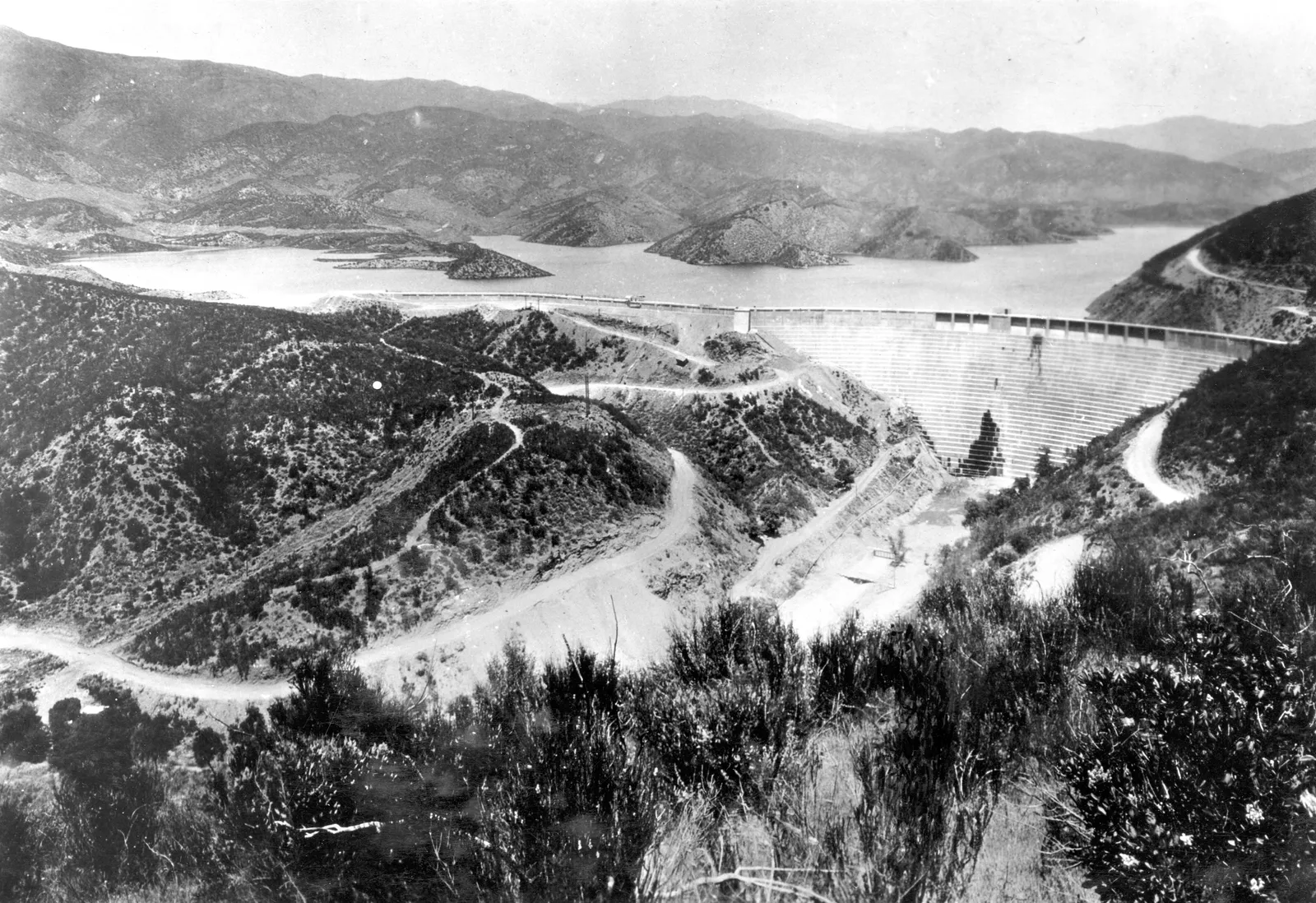
However, the explosive population boom of Los Angeles created an insatiable thirst. Desperate to secure a year’s emergency reserve of municipal water in case Owens Valley ranchers dynamited the aqueduct during the bitter “California Water Wars,” Mulholland designed a massive curved concrete gravity dam in San Francisquito Canyon, forty miles north of downtown Los Angeles: the St. Francis Dam.
The Flawed Colossus
Completed in 1926, the St. Francis Dam was a curved concrete gravity dam standing 185 feet high, designed to impound 12.4 billion gallons (38,000 acre-feet) of mountain runoff.
Yet Mulholland’s autocratic self-reliance led him to make fatal design errors:
- Unilateral Height Increases: During construction, Mulholland twice ordered the height of the dam raised by a total of twenty feet to increase storage capacity, without widening the dam’s base foundation to compensate for the exponential increase in hydrostatic head pressure.
- Ignored Geological Weaknesses: The dam’s eastern wing was anchored directly into Pelona schist—a soft, heavily foliated rock with natural fault planes lubricated by water. The western wing rested upon the conglomerate Sespe Formation, a redbed rock that disintegrated into mud when soaked in water.
- No Independent Peer Review: Mulholland was so revered that city supervisors approved his blueprints without submitting the site to independent geological consulting or federal safety inspection.
By March 1928, heavy winter runoff filled the reservoir to maximum capacity for the first time in its history. The water reached the lip of the spillway.
The Morning Inspection: March 12, 1928
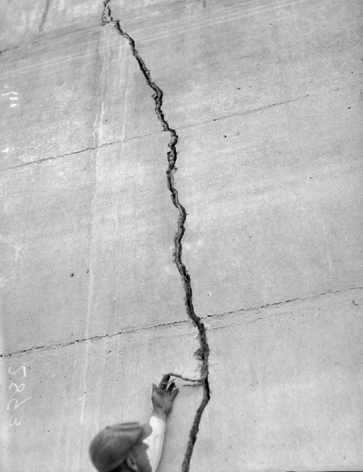
On the morning of Monday, March 12, 1928, dam keeper Tony Harnischfeger noticed muddy water discharging from a newly opened fissure near the western abutment. Muddy water was an ominous indicator that reservoir water was actively washing away the geological foundation beneath the concrete.
Harnischfeger placed an urgent telephone call to LADWP headquarters in Los Angeles.
Around 10:30 AM, seventy-two-year-old William Mulholland and his chief assistant, Harvey Van Norman, arrived at the dam. For two hours, the veteran engineers inspected the leak. Mulholland observed that the runoff water was running clear where it met the canyon creek, concluding that the muddy sediment was merely surface clay washed down by highway construction above.
Mulholland pronounced the dam entirely sound, ordered minor drain clearing, and returned to Los Angeles.
The Midnight Rupture
At 11:57 PM that very night—less than twelve hours after Mulholland’s inspection—the St. Francis Dam suffered a catastrophic, total structural collapse.
The saturated Sespe conglomerate on the west and the sheared Pelona schist on the east gave way under enormous hydrostatic uplift. With a roar that shook the canyon like an earthquake, the massive concrete wings ruptured.
Twelve billion gallons of water—weighing nearly fifty million tons—burst through the breach in a towering 140-foot wall of water.
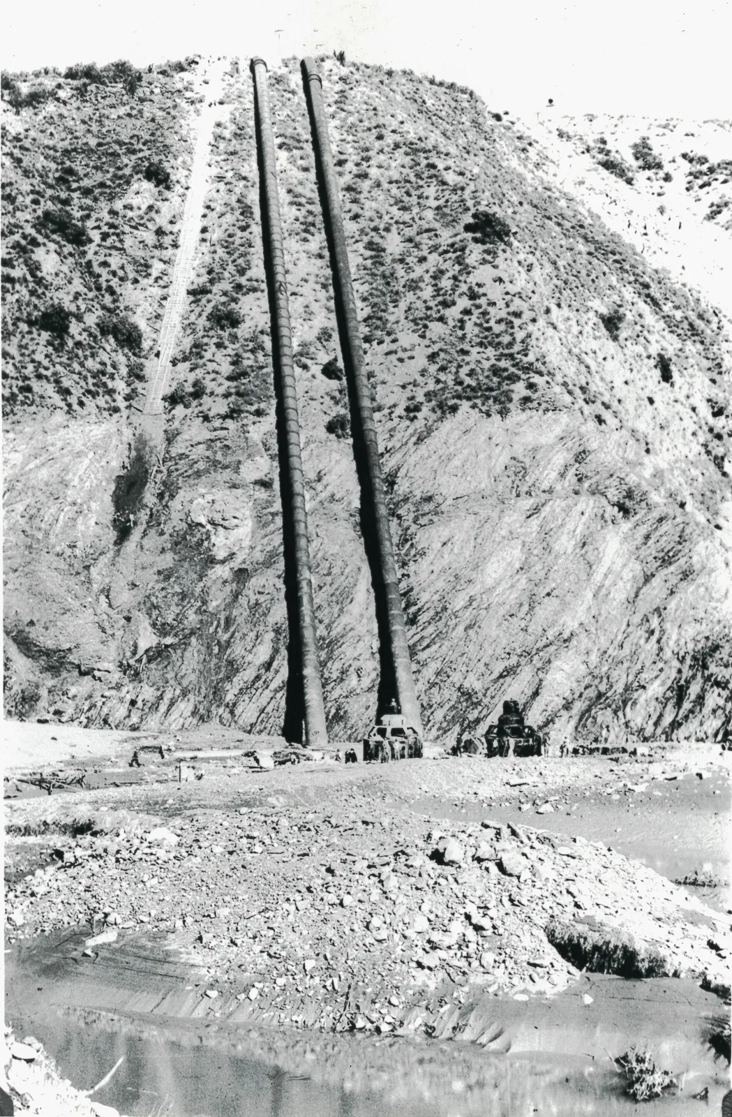
- Powerhouse No. 2 Obliterated: One and a half miles down the canyon, the municipal hydroelectric Powerhouse No. 2 was instantly struck by a 120-foot crest. The heavy concrete powerhouse, residential cottages, and sleeping utility workers were vaporized; sixty-four of sixty-seven residents were killed in seconds.
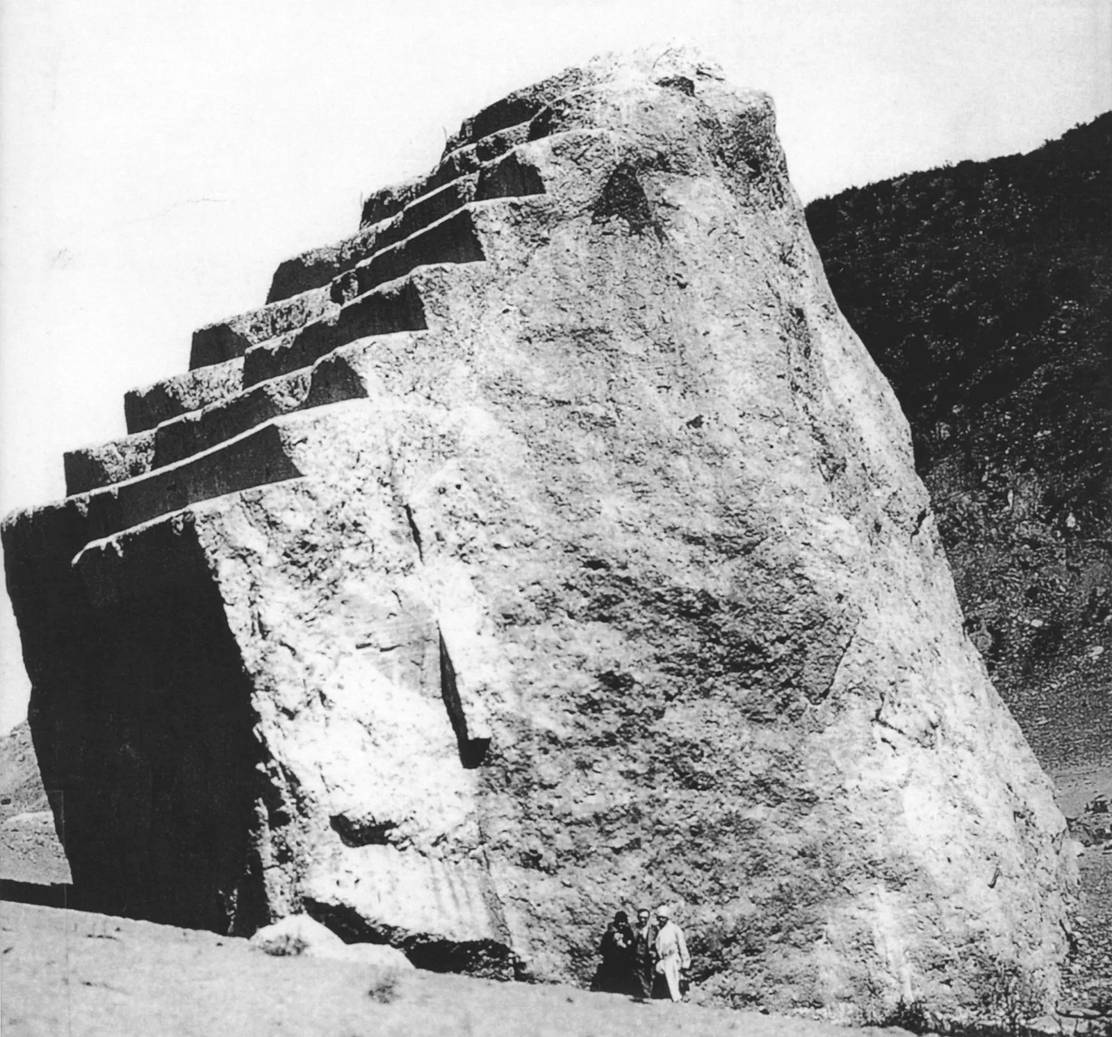
- The Roaring Churn: The flood surged down San Francisquito Canyon at eighteen miles per hour, stripping soil down to bedrock and rolling colossal 10,000-ton concrete monoliths—blocks the size of suburban houses—over a half-mile downstream.
Path of Destruction to the Pacific
The roaring wave slammed into the Santa Clara River at Castaic Junction, turning west toward the Pacific Ocean.
Over the next five hours, the fifty-four-mile flood wave carved an apocalyptic path through Ventura County:
- In Piru, Fillmore, and Santa Paula, telephone operators like Louise Gipe heroically remained at their switchboards in the dead of night, calling downstream farmhouses to warn sleeping families until floodwaters smashed through the telephone exchanges.
- Entire railroad bridges were twisted like wire, and orchards of citrus trees were uprooted and swept away.
- At 5:30 AM on March 13, the mud-choked deluge discharged into the Pacific Ocean near Montalvo and Ventura, carrying victims’ bodies and wreckage into the open sea.
Over four hundred people perished—the exact death toll remains unknown because hundreds of migrant agricultural workers living in temporary labor camps along the riverbanks were washed out to sea without records.
“I Envy the Dead”
At the coroner’s inquest in Los Angeles, William Mulholland took the witness stand, his hair turned stark white and his shoulders slumped under crushing grief. When questioned about the catastrophic loss of life, the broken giant did not deflect blame or hide behind legal counsel:
“Don’t blame anybody else. You just fasten it on me. If there was an error in human judgment, I was the human. The only ones I envy about this whole thing are the ones who are dead.”
The jury cleared Mulholland of criminal negligence, finding that the geological instability of the canyon could not have been detected with the standard engineering methods of the 1920s. However, Mulholland resigned in disgrace, retreating into his home in seclusion until his death in 1935.
The disaster transformed American infrastructure forever. In 1929, the California legislature enacted mandatory state inspection laws and created the Division of Safety of Dams, ending the era of the all-powerful independent engineer and establishing the modern system of geological surveying and peer review that safeguards dams worldwide.
What the Record Shows
8 sourced claims in this story, resting on 4 primary and engineering historical records. Numbers link to the bibliography below.
- The St. Francis Dam was completed in 1926 under Chief Engineer William Mulholland to store 12 billion gallons of water - sources: 3
- Muddy leaks appeared on the face of the dam on the morning of March 12, 1928, inspected by Mulholland and pronounced safe - sources: 2
- At 11:57 PM on March 12, 1928, the dam catastrophically collapsed, unleashing a 140-foot wall of water - sources: 4
- The flood surge carried 10,000-ton concrete blocks up to three-quarters of a mile down San Francisquito Canyon - sources: 2, 4
- Over 400 people perished as the flood destroyed towns all the way to the Pacific Ocean near Ventura - sources: 2, 3
- Geological failure occurred due to unstable Sespe redbeds and Pelona schist foundations under hydrostatic uplift - sources: 5
- At the coroner’s inquest, Mulholland took full responsibility, stating he envied the dead - sources: 2, 4
- The catastrophe led directly to the creation of independent state dam safety oversight legislation in California - sources: 3
Archival Evidence & Picture Credits
- Scene 1: The St. Francis Dam in 1926 - Los Angeles Department of Water and Power, Public domain (source)
- Scene 2: Portrait of William Mulholland with surveyor scope - USC Libraries / CHS Collection, Public domain (source)
- Scene 3: Structural cracks inspected on remaining dam face - Santa Clarita Valley Historical Society, Public domain (source)
- Scene 4: Ruins of Powerhouse No. 2 after the flood - LADWP Archives, Public domain (source)
- Scene 5: Monolith section of dam washed downstream - Ventura County Historical Museum, Public domain (source)


Verified Archival Sources & Bibliography
Every claim in this account has been fact-checked against primary archives and scholarly engineering literature:
- Jon Wilkman, Floodpath: The Deadliest Man-Made Disaster of 20th-Century America and the Making of Modern Los Angeles (Bloomsbury) (definitive historical monograph)
- Wikipedia: St. Francis Dam (reference)
- Santa Clarita Valley Historical Society: The St. Francis Dam Disaster Archives & Inquest Records (primary coroner inquest transcripts)
- United States Geological Survey (USGS): Geology of the San Francisquito Canyon Dam Site (primary federal survey)
Echoes of History Uncut. "He Swore This Dam Was Safe. Hours Later, It Wiped Out an Entire Valley.." Echoes of History Uncut. Last modified September 20, 2026. https://echoesofhistoryuncut.com/articles/st-francis-dam-collapse/.

An independent history publication using AI-assisted research, drafting and production. Consult each article’s citations and limitations; source inclusion does not establish independent verification of every claim.
▶
Watch the Complete Archival Documentary on YouTube
Subscribe to Echoes of History Uncut on YouTube for full widescreen 16:9 documentaries, primary archival footage, and declassified deep dives.